


La Chapelle de Brain

chasle
User
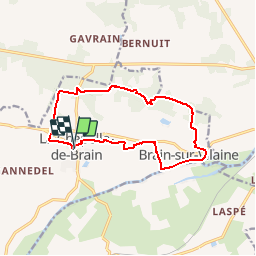

Length
12.7 km

Max alt
71 m

Uphill gradient
191 m
Km-Effort
15.3 km

Min alt
1 m

Downhill gradient
196 m
Boucle
Yes
Creation date :
2019-10-09 16:51:16.961
Updated on :
2019-10-09 16:52:03.503
3h19
Difficulty : Easy

FREE GPS app for hiking
 SityTrail
IGN / Geographical institutes
SityTrail Plus
The world is yours!
About
Trail Walking of 12.7 km to be discovered at Brittany, Ille-et-Vilaine, La Chapelle-de-Brain. This trail is proposed by chasle.
Positioning
Country:
France
Region :
Brittany
Department/Province :
Ille-et-Vilaine
Municipality :
La Chapelle-de-Brain
Location:
Unknown
Start:(Dec)
Start:(UTM)
579873 ; 5283421 (30T) N.
Comments